Analyzed Upper Air Charts (Monteverdi and Edwards 2010)
for Supplemental Fig. 11
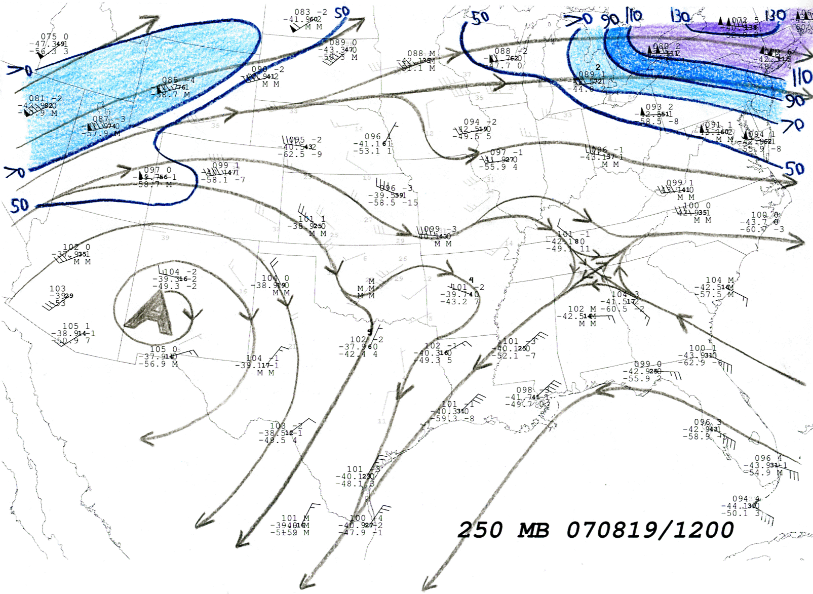
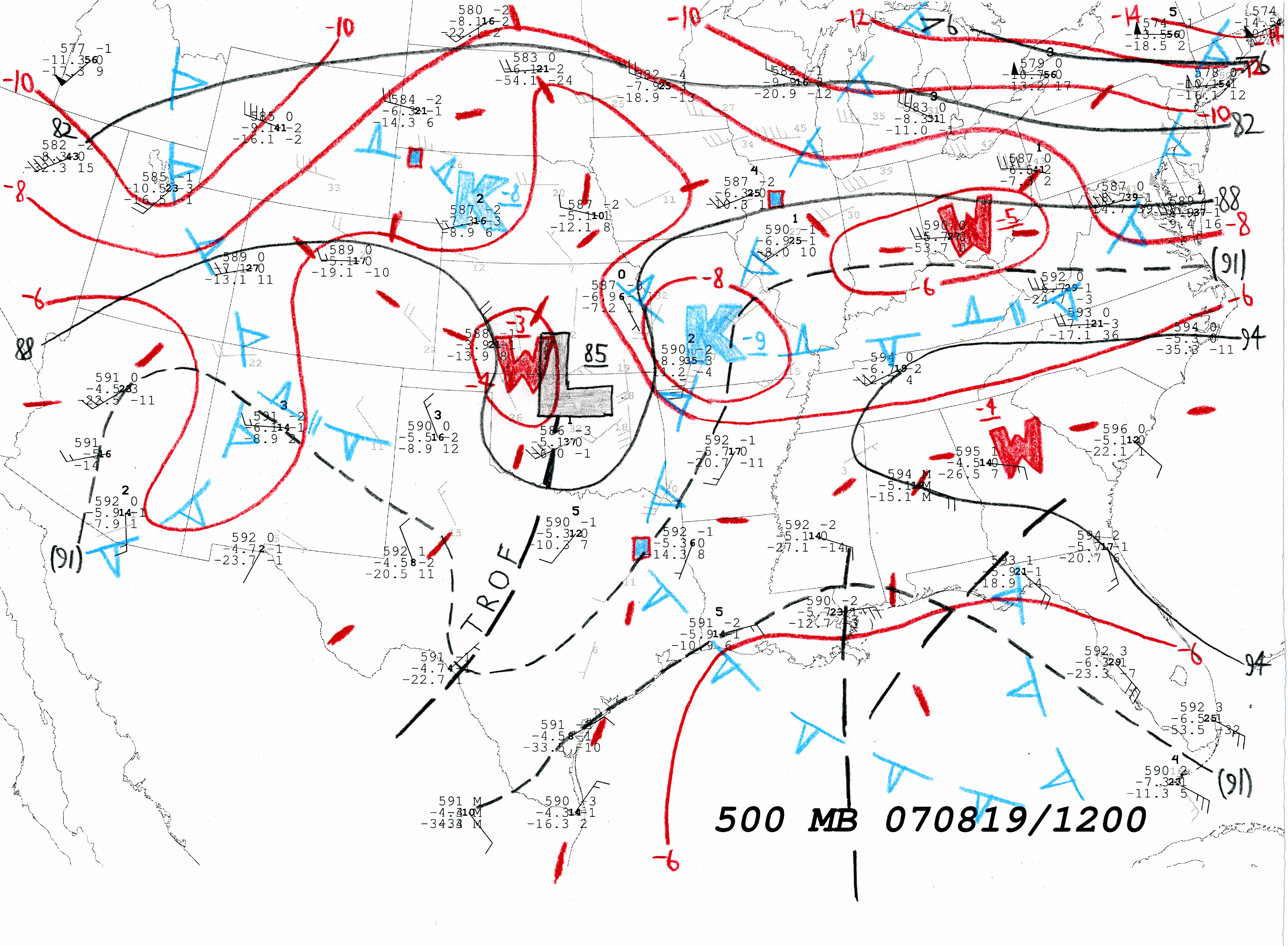
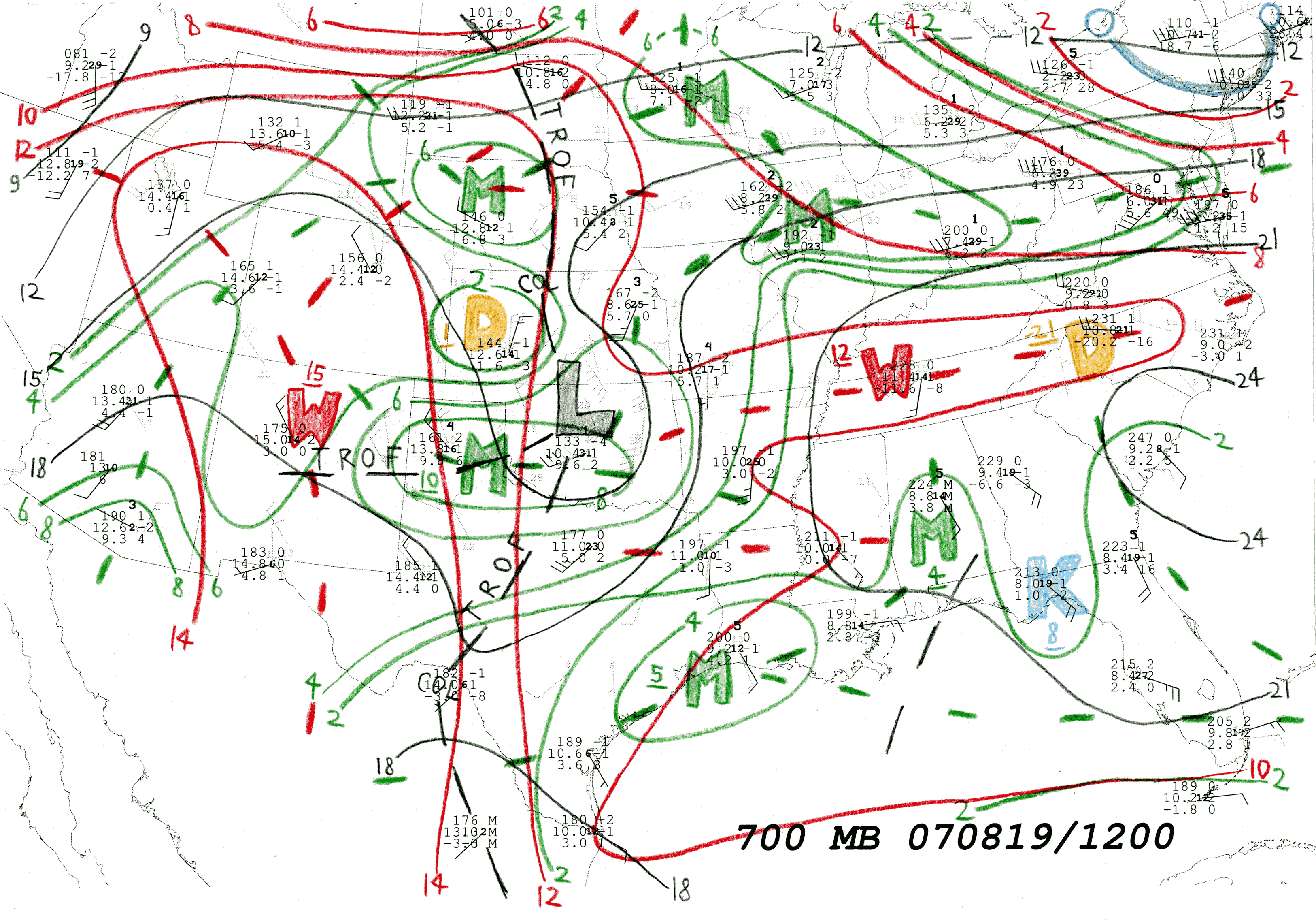
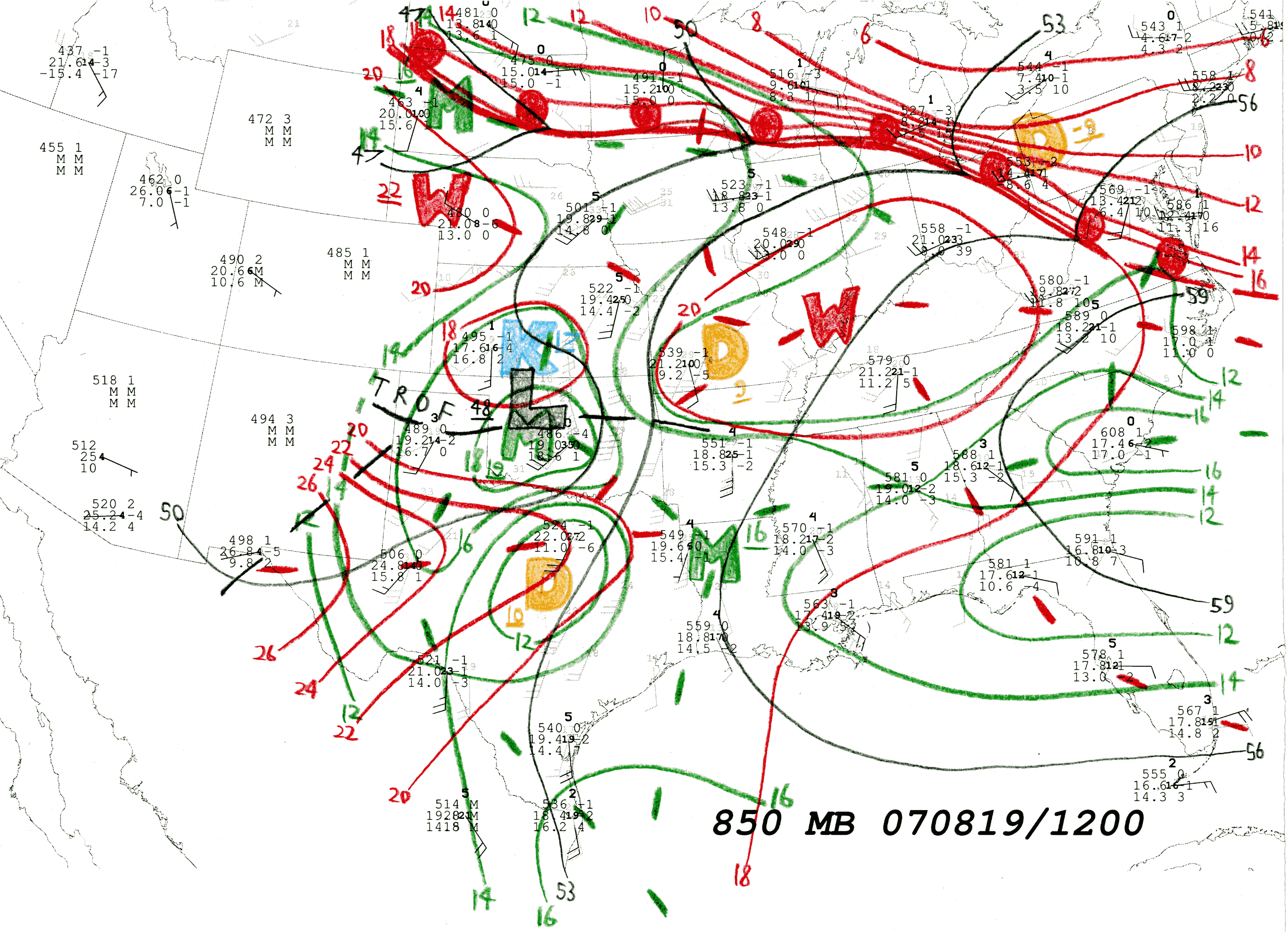
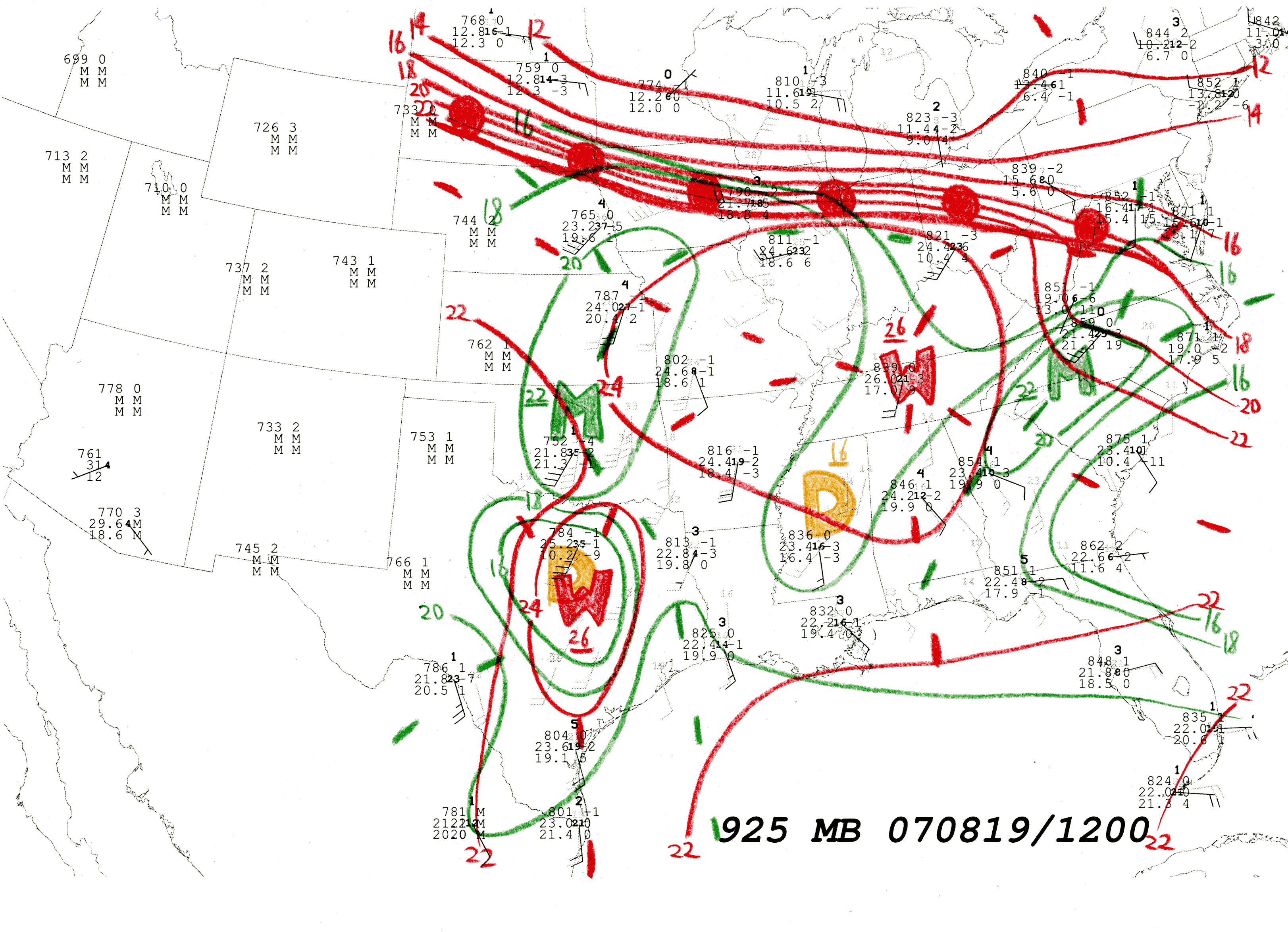
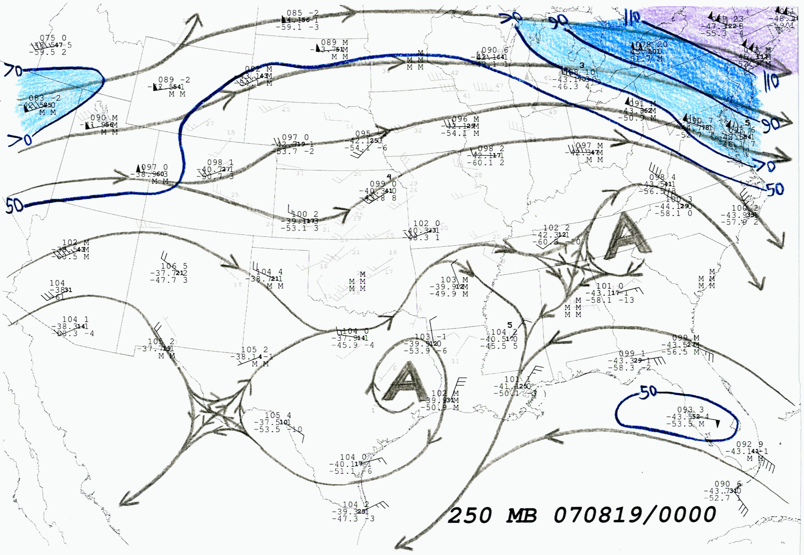
All charts: Rawinsonde observations plotted in black. Full barbs represent 10 kt (5 m s-1), flags are 50 kt (25 m s-1). At left of each rawinsonde plot, heights are in conventionally truncated decameter notation, above temperatures and dew points in oC. 12 h change in each value is plotted in corresponding position at right, where available. Otherwise M denotes "missing". Bold numerals at center denote more specific wind speed to the nearest whole integer. Gray wind observations represent locations and values of all available WSR-88D Velocity-Azimuth Display (VAD) winds and NOAA wind profiler values at synoptic time specified.
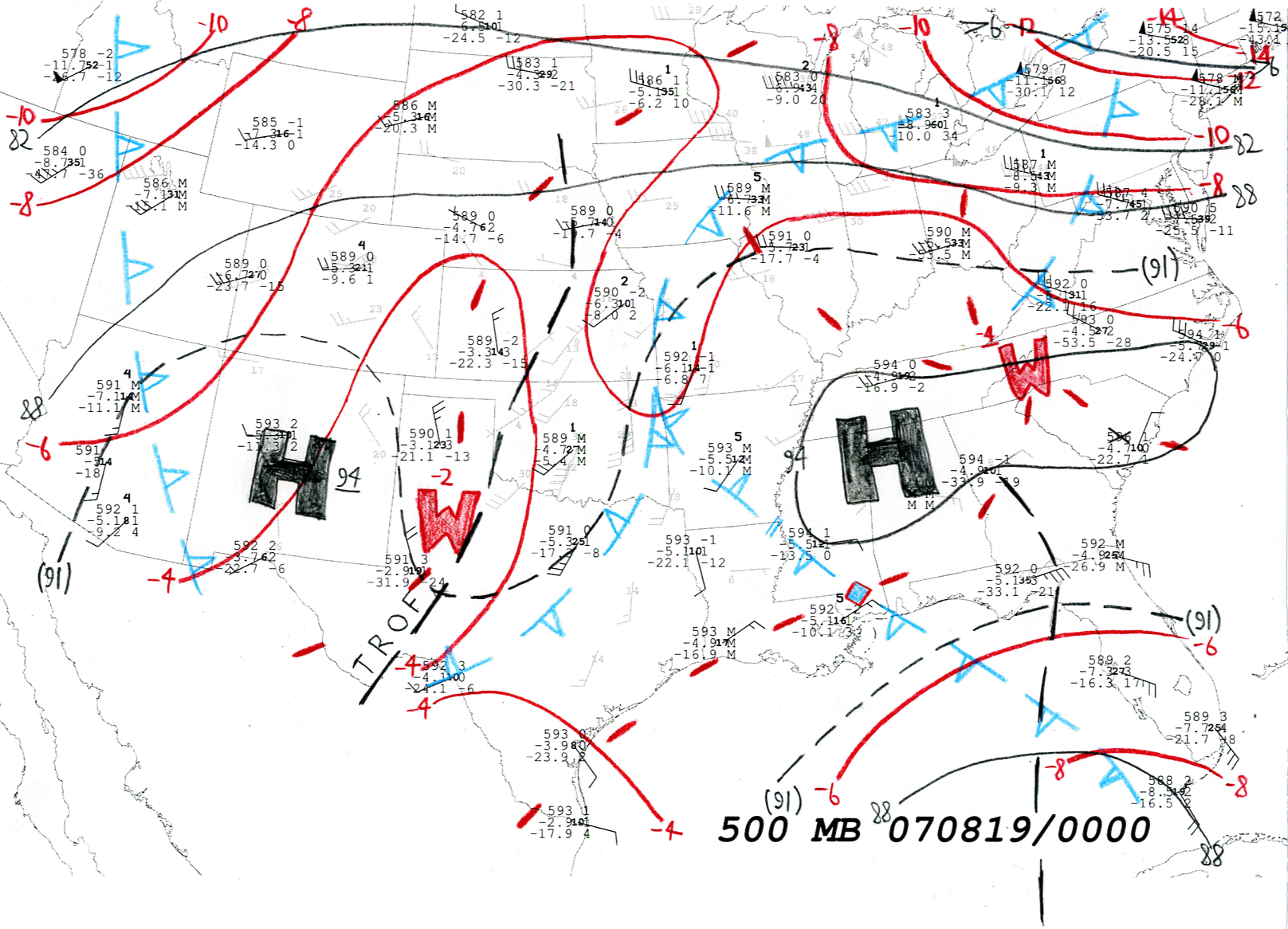
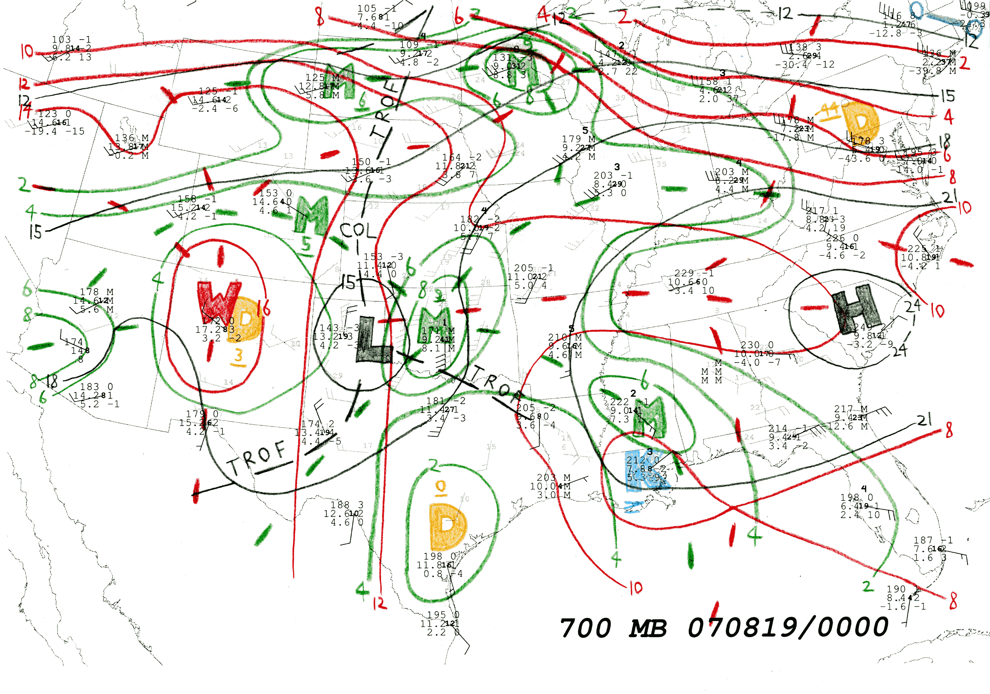
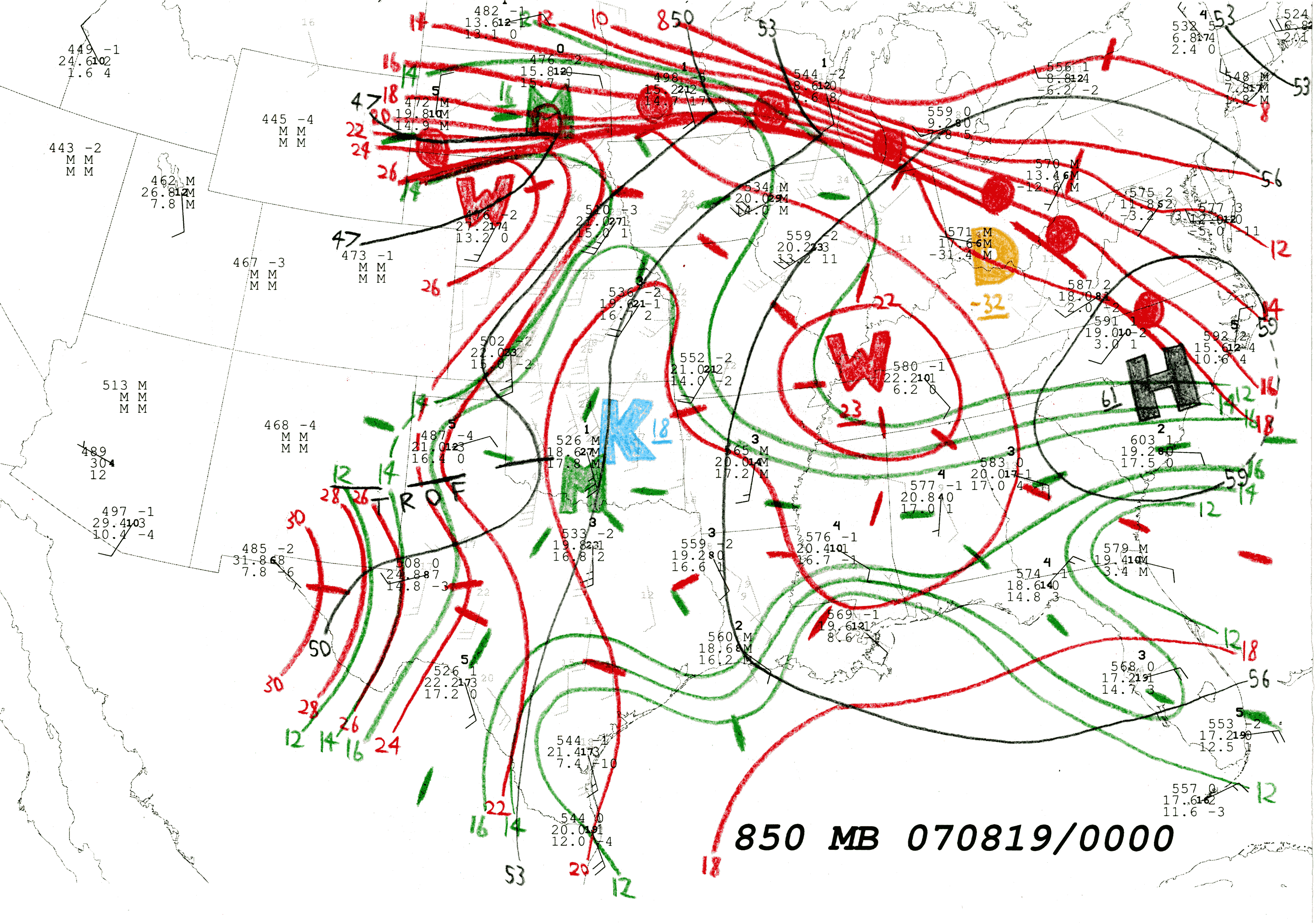
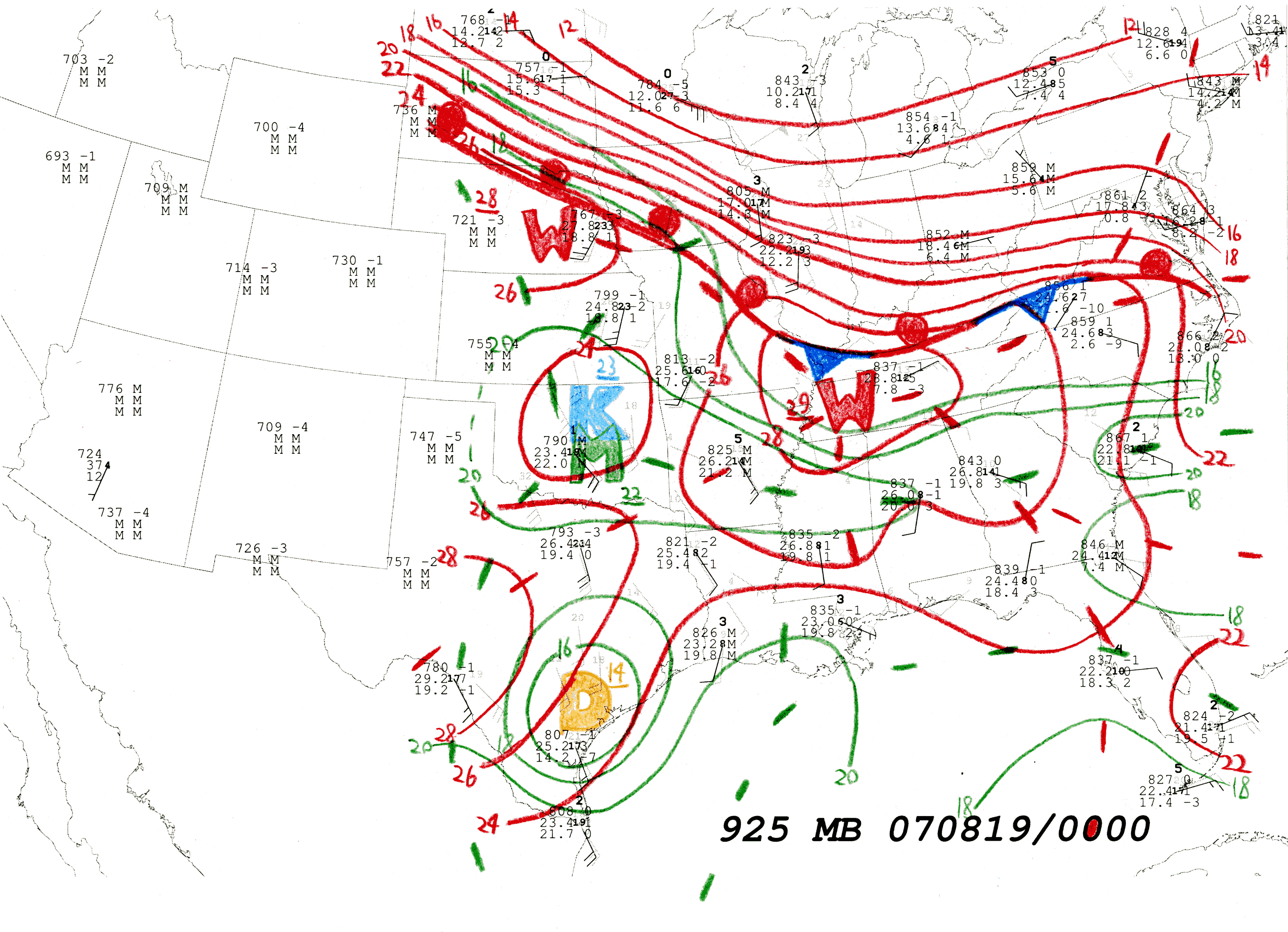
Scanned maps for 0000 UTC 19 August 2007
250 hPa: Streamlines in gray. Isotachs in navy blue every 20 kt (10 m s-1), beginning at 50 kt (25 m s-1), shaded in progressively darker blue then purple hues beginning at 70 kt (35 m s-1). A represents approximate center of anticyclones.
500 hPa: Isohypses, highs, lows and troughs in black, with intermediate (30 m interval) isohypses as necessary in dashes. Isotherms in red. Thermal ridges are thick red dashes, with warm maxima denoted by W. Thermal troughs are hollow, dashed pips in cyan, minima denoted by K. Thermal cols are denoted by cyan-filled red diamonds.
700 hPa: Isohypses every 30 m. Isotherms and thermal maxima and minima as on 500 hPa chart. Isodrosotherms in green beginning with 2 oC. Isodrosothermal axes in thick green dashes. Dewpoint maxima denoted by M. Dewpoint minima denoted by tan D (dry) symbol.
850 hPa: Isohypses, isotherms, axes and thermal maxima and minima as on 700 hPa chart. Isodrosotherms in green, beginning at 12 oC. Fronts drawn conventionally.
925 hPa: Isohypses, isotherms and thermal maxima and minima as on 700 hPa chart. Isodrosotherms in green, beginning at 16 oC. Fronts drawn conventionally.
Scanned maps for 1200 UTC 19 August 2007 brAnalysis conventions same as with 0000 UTC map set.
250 hPa
500 hPa
700 hPa
850 hPa
925 hPa
END OF CHART SET