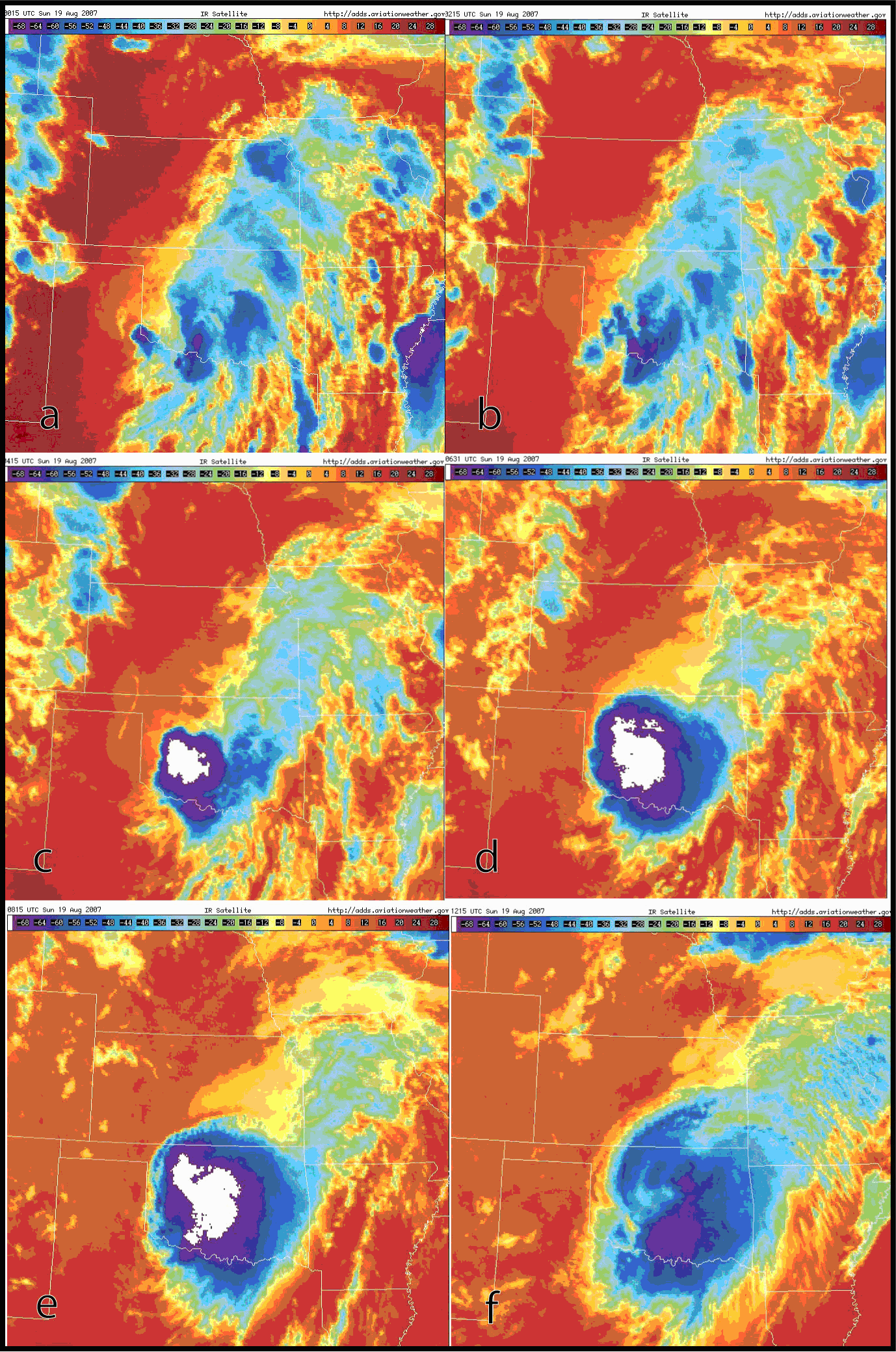
Figure 6. Enhanced infrared satellite images at: a) 0040, b) 0240, c) 0440, d) 0640, e) 0840, and f) 1040 UTC 19 Aug 2007, thermal scales in ºC. Expansion and cooling of cloud tops occurred through
0840 UTC, with warming from about 1040 UTC onward. Courtesy Aviation Weather Center.
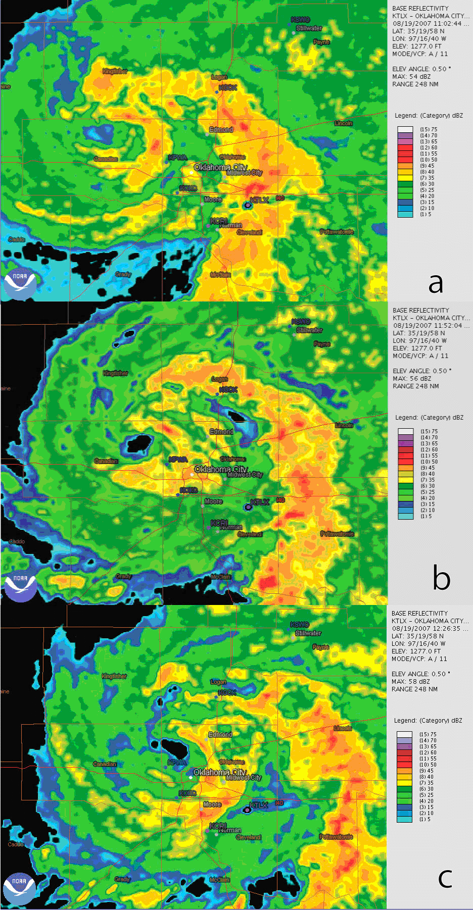
Figure 7. (Base reflectivity (0.5° tilt, values in legends) from KTLX for a) 1102, b) 1152 and c) 1224 UTC,
representing snapshots of the evolution of the precipitation-free eye of TC Erin over central Oklahoma.