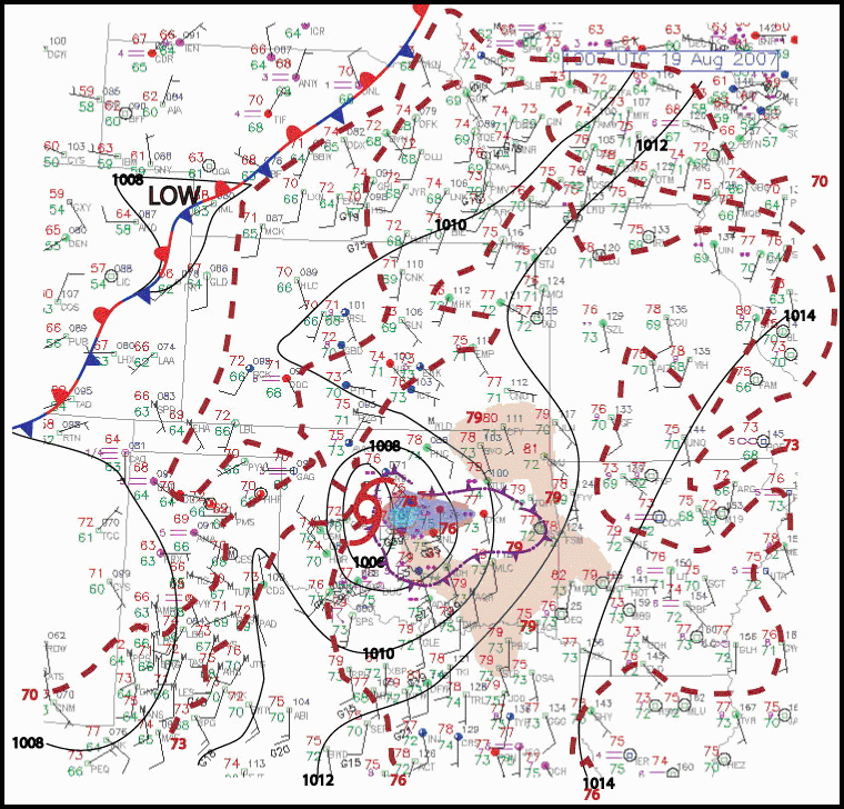
Figure 8. Subjective analysis of isobars (black) and isotherms (dashed red) at 1007 UTC 19 August 2007.
Red shading indicates area with temperatures exceeding 79 ºF (26 ºC); blue shading outflow pool with temperature less than 73 ºF (23 ºC).
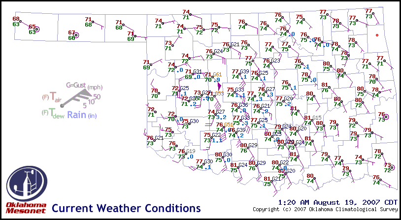
Figure 9. Conventional plot of Oklahoma Mesonet observations at 0620 UTC 19 August 2007.
Wind barbs represent gusts in mph per legend, with temperature and dew point values in °F.
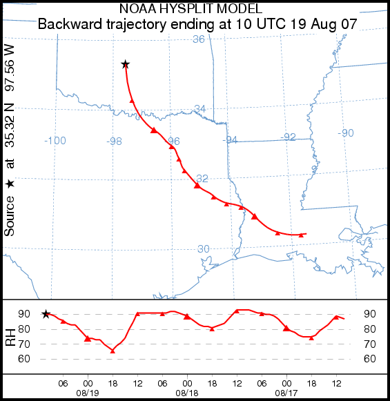
Figure 10. 72 h backward trajectory analysis (tick marks at 6 h intervals) of the 10 m AGL (surface) parcel,
ending at the star (Oklahoma City) at 1000 UTC 19 August. The underlying graph, read from right to left,
shows relative humidity of the parcel with time following the trajectory, with tick marks
corresponding to those on the planar map. Courtesy NOAA.
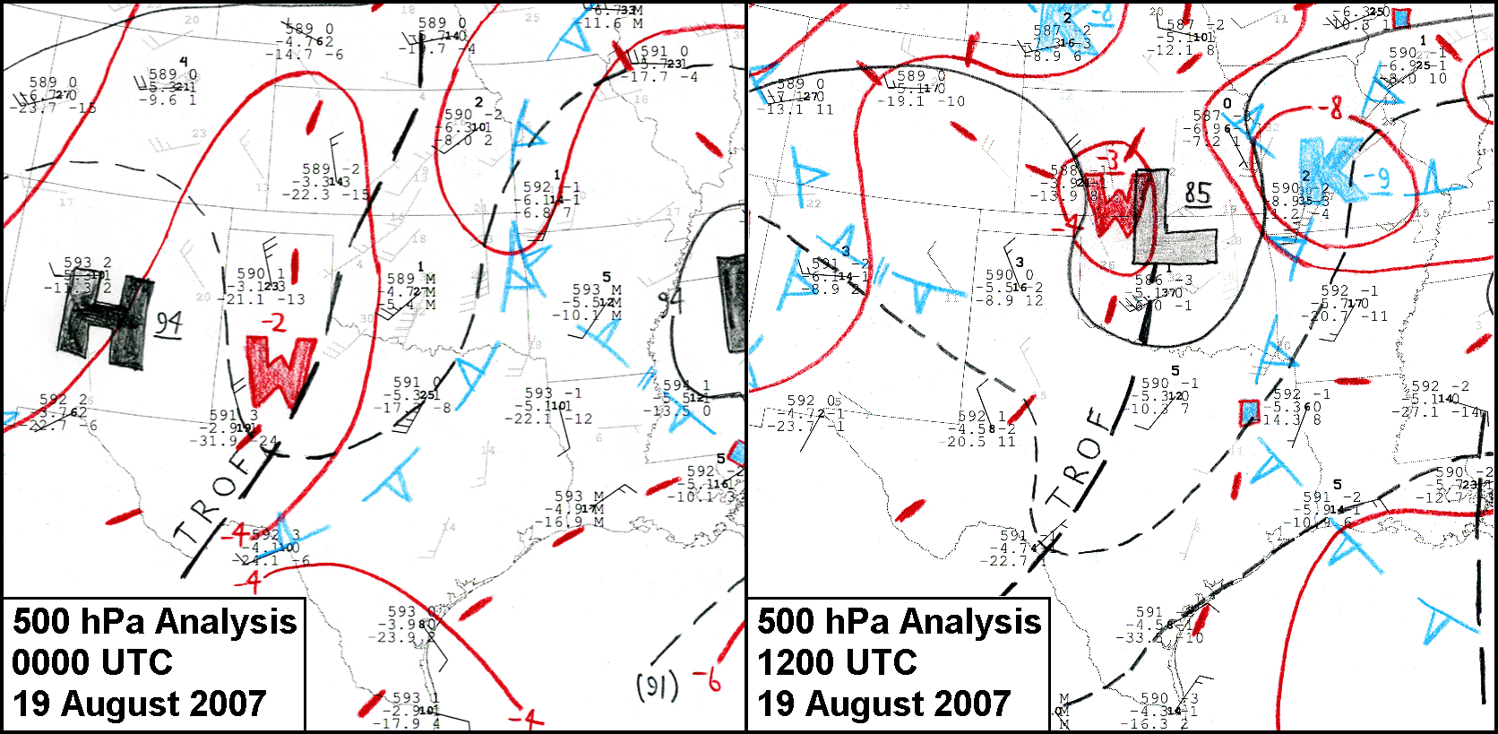
Manual 500-hPa analyses as labeled with conventional rawinsonde station plots, covering south-central U.S. region, 0000 UTC 19 August 2007.
Gray-shaded wind plots represent profiler data and WSR-88D velocity-azimuth display (VAD) winds. Solid isohypses drawn at 6 dam intervals, intermediates dashed, height troughs labeled. Isotherms in red at 2º C intervals.
Thermal troughs in open blue pips, with minima labeled K. Click here for complete sets of hand-analyzed, mandatory-level charts for both synoptic times, covering a larger domain over the southern and eastern U.S.
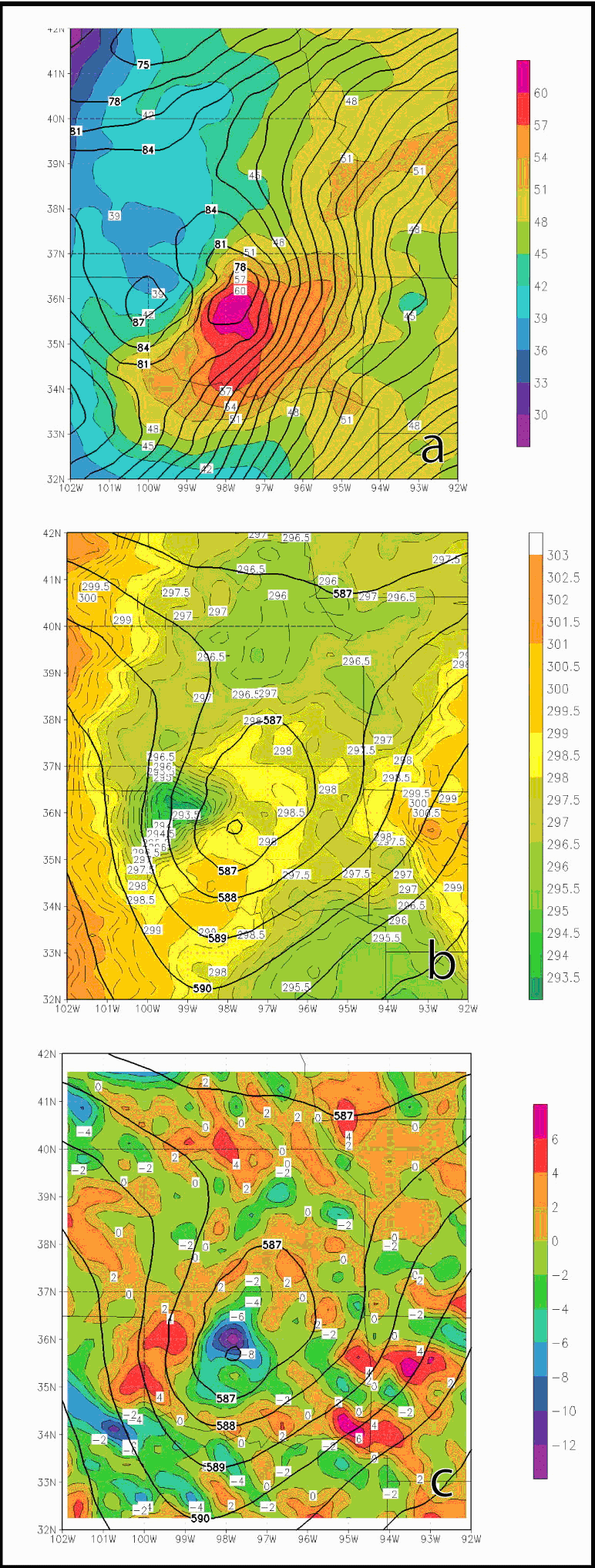
Figure 12. Plots obtained by NCEP Reanalysis for 1200 UTC 19 August
2007 of a) 1000-hPa heights (m) overlain with total precipitable water
in the column from the surface to the top of the atmosphere (mm);
b) 500-hPa heights (dam) overlain with θ (K); and c) 500-hPa heights
(dam) overlain with 1000-hPa divergence (10-5s-1).
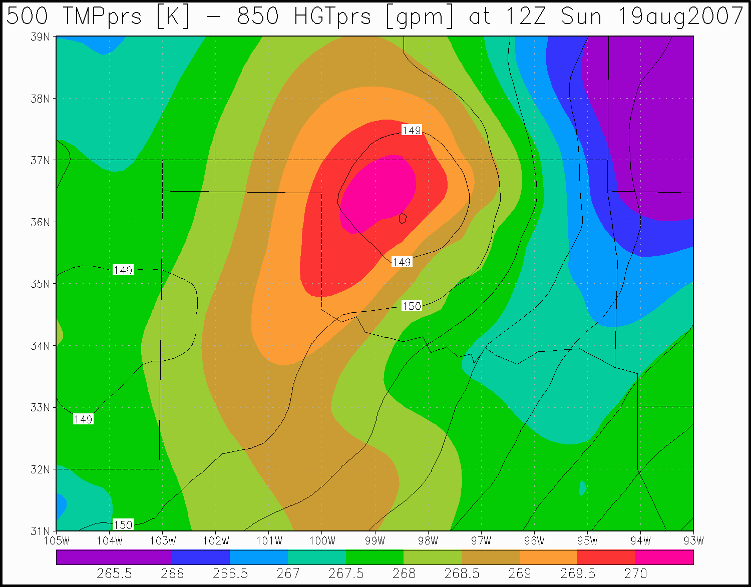
Figure 13. 500-hPa temperatures (ºC) and 850‑hPa heights (dam) at 12 UTC 19 August 2007, obtained by NCEP Reanalysis. Note the collocation of the
warmest temperatures 500-hPa temperatures with the lowest heights at 850 hPa(and other lower levels, not shown).
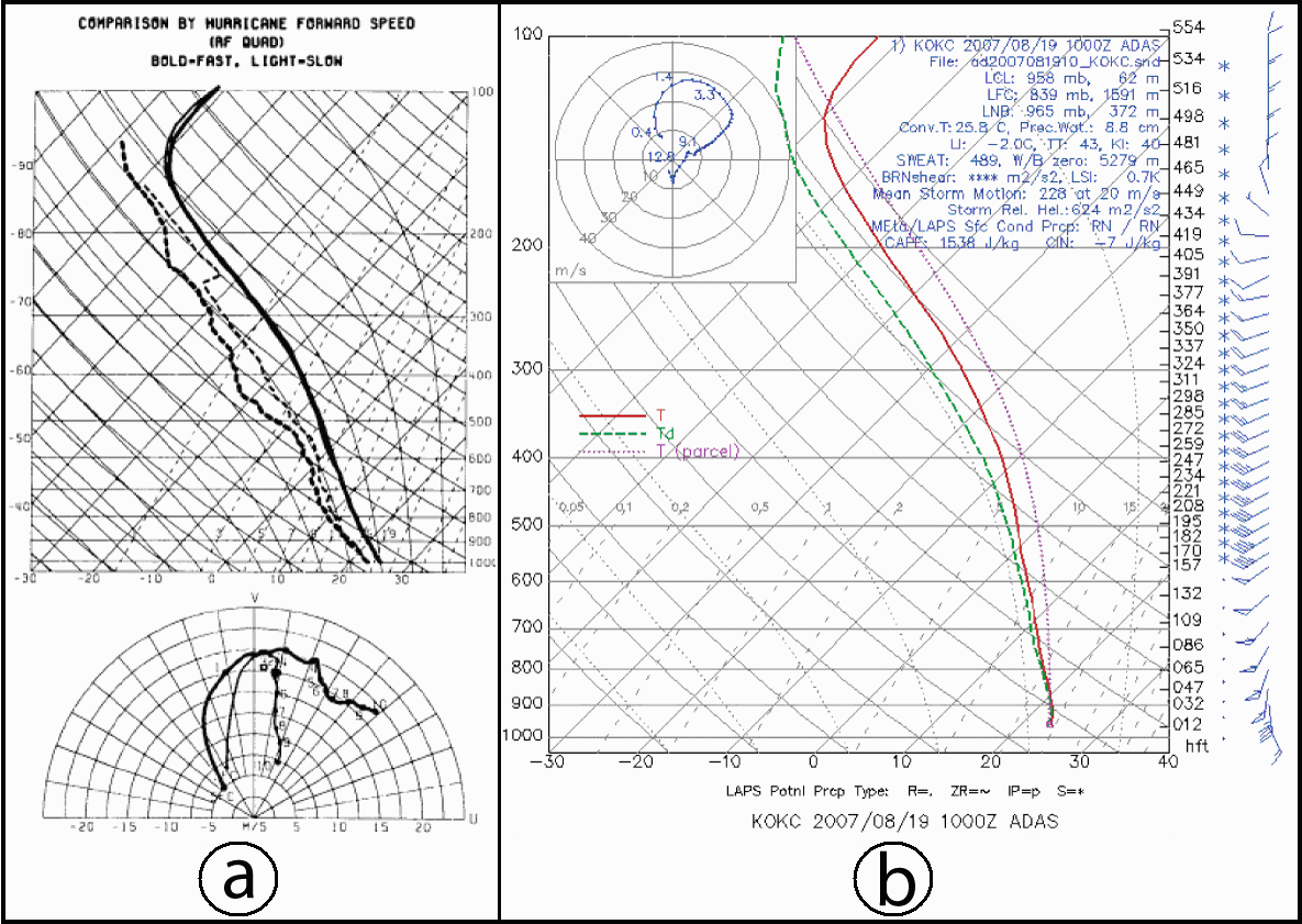
Figure 14. a) Composite soundings and hodographs for right-front quadrant of landfalling tropical systems (from McCaul 1991)
(bold—fast moving systems; light—slow moving systems); and b) ADAS sounding and hodograph for KOUN (Norman, OK) at 1000 UTC 19 August 2007.